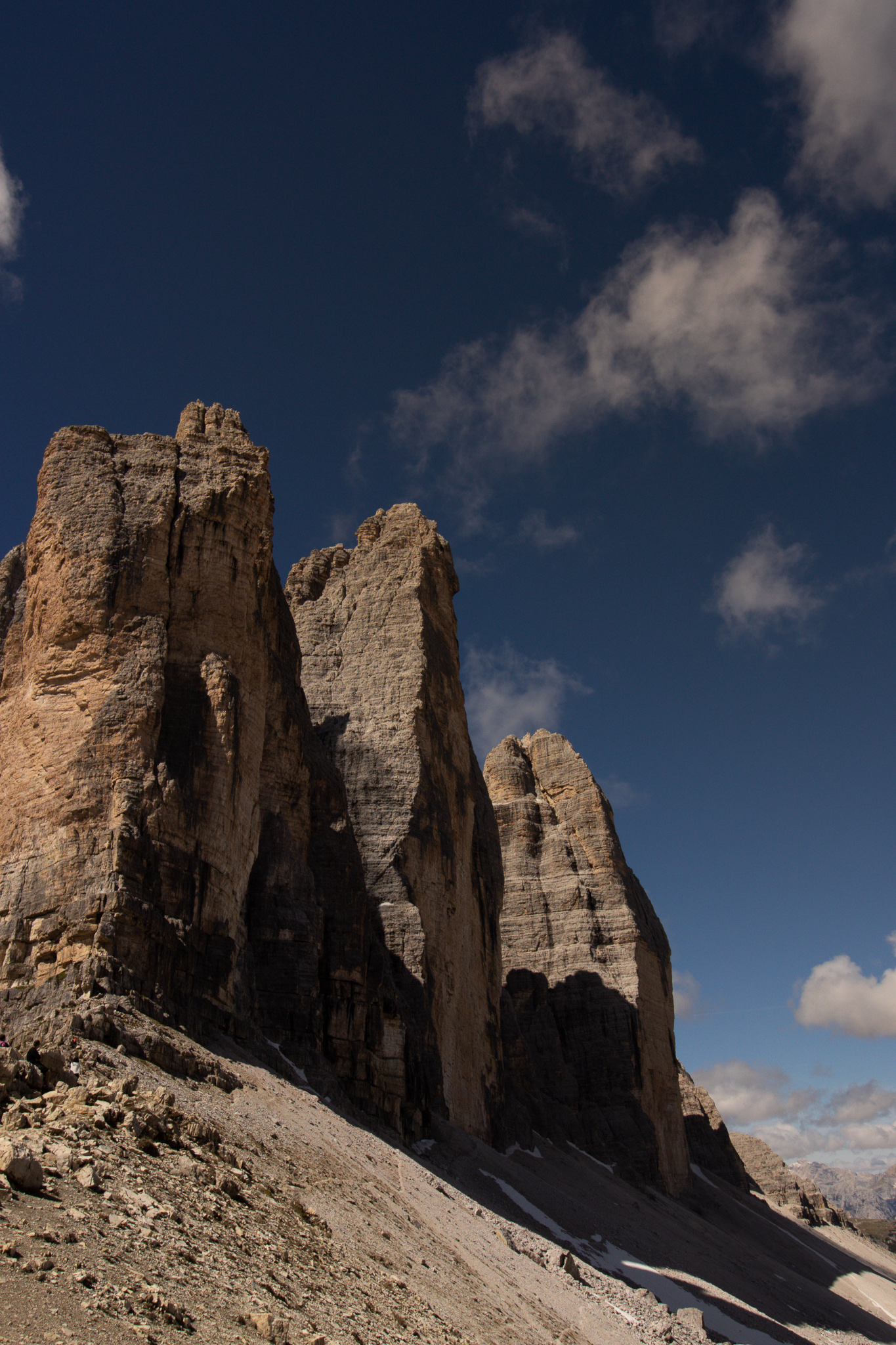
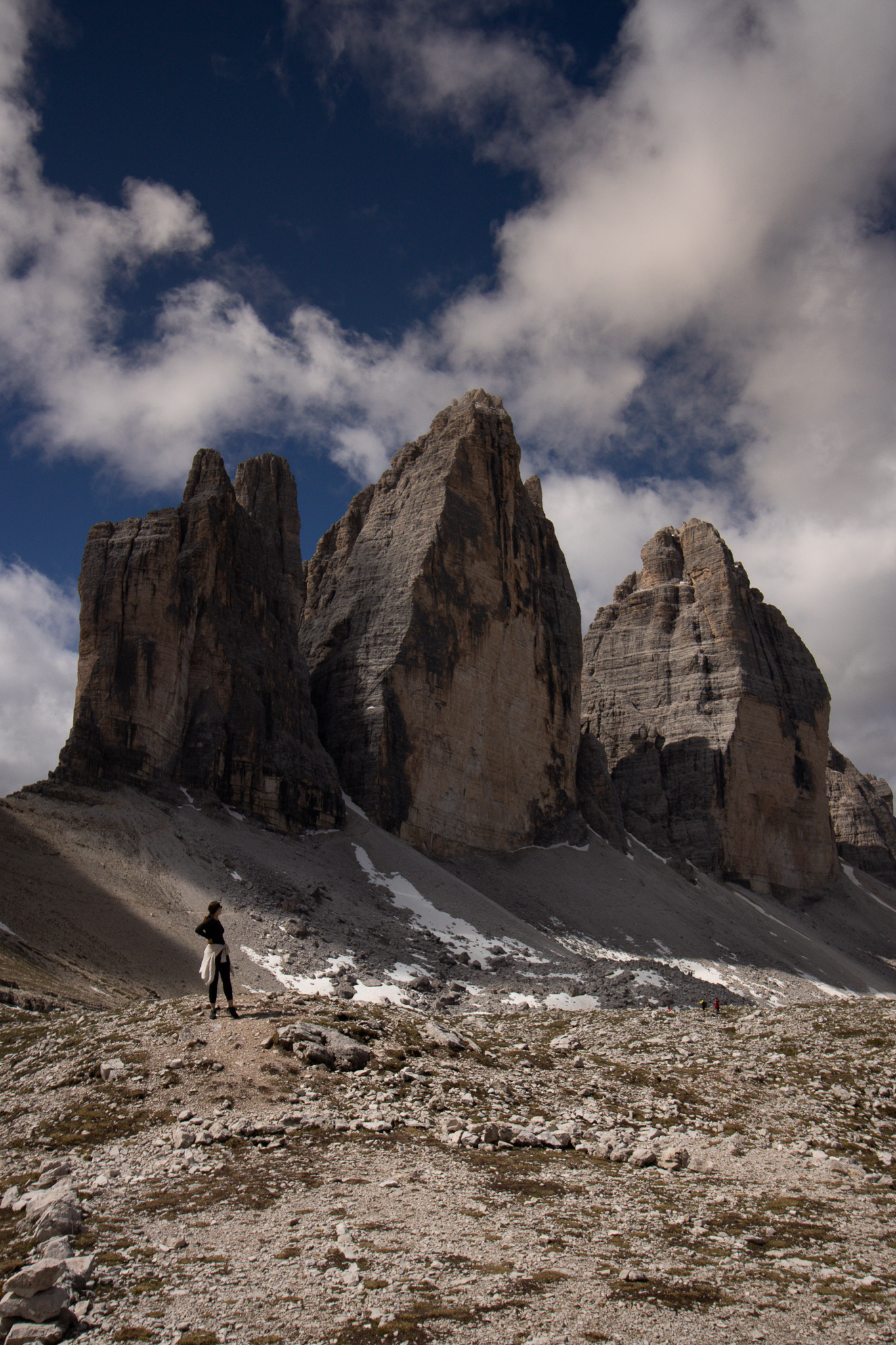
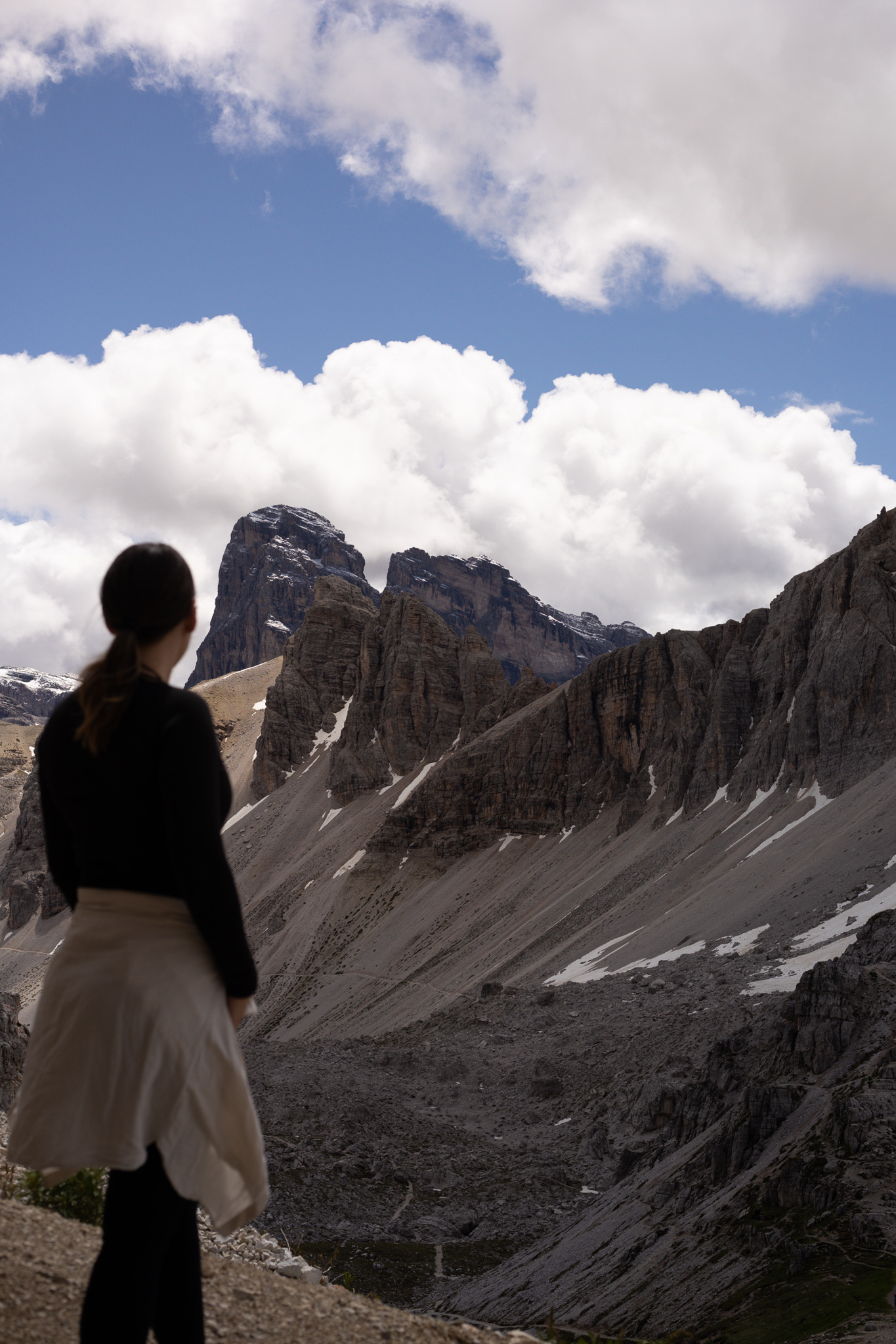
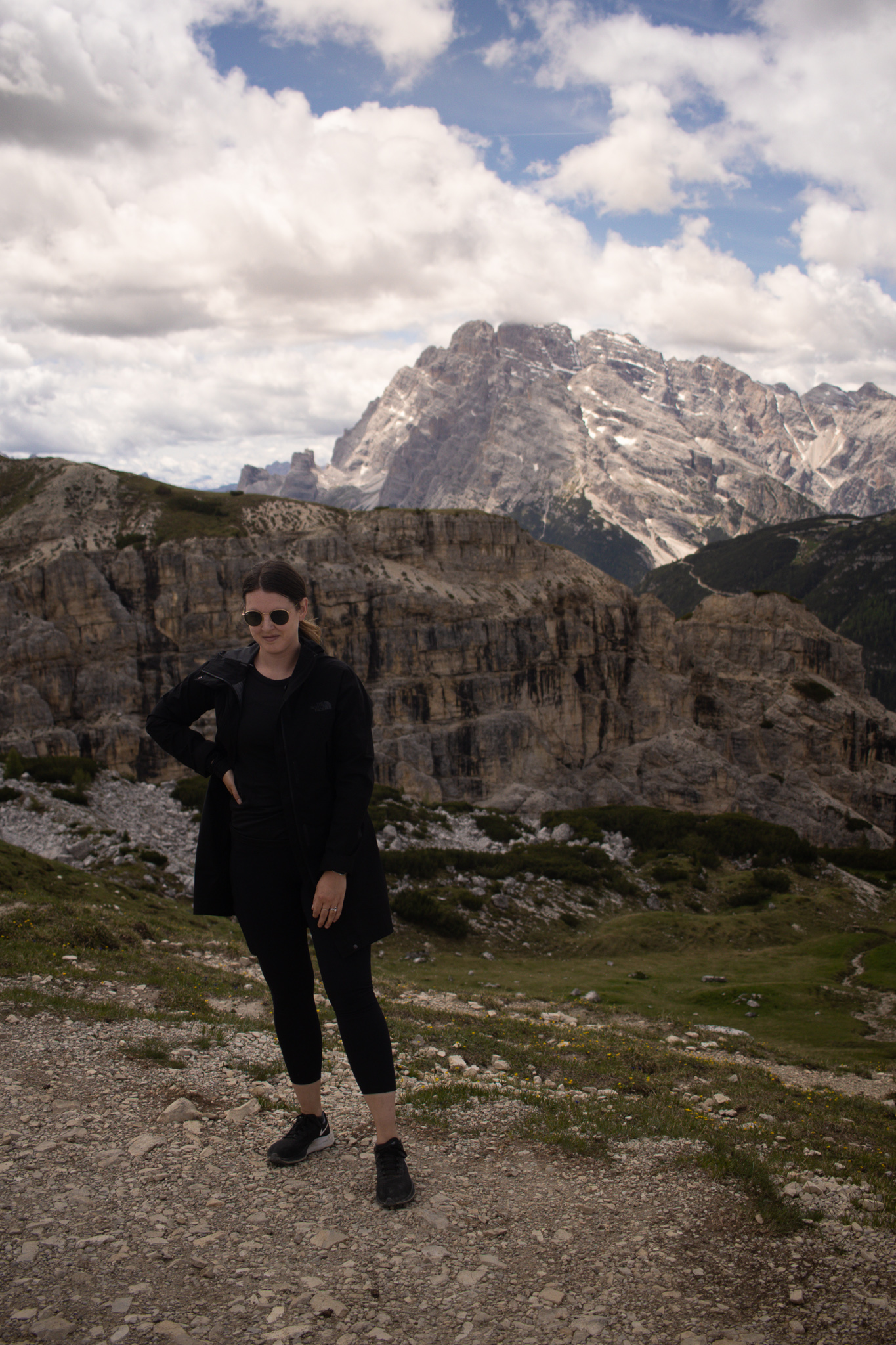
Hiking in the Dolomites was a bucket list experience and one that we highly recommend. Located in the Northern Italian Alps, the Dolomites are home to expansive mountain ranges with stunning rock formations. Tre Cime Di Lavaredo is one of the most iconic mountain ranges and the symbol of the Italian Dolomites UNESCO World Heritage Site. So, if you choose to do one thing in the Dolomites we highly recommend opting for the Tre Cime Di Lavaredo loop hike. This hike will showcase the jagged mountain ranges perfectly, along with many other stunning views.
For everything you need to know about hiking in the Dolomites and the Tre Cime Di Lavaredo loop – keep reading!
Table of Contents
Tre Cime Di Lavaredo Loop Hike Quick Facts:
Distance: 10 km (6.2 miles) | Difficulty: easy to moderate | elevation change: 340-400m | duration: 3.5 hours | season: mid June to mid September

How Long is the Tre Cime di Lavaredo Loop hike?
The Tre Cime di Lavaredo loop hike is a 10 km, 6.2 mile, long hike. The hike itself is relatively easy albeit long which is where the moderate rating comes from. The hiking trail is well marked and packed down, so there’s no scrambling involved. Furthermore, the elevation gain comes from hiking down and then back up a valley, so it’s not a continuous up hill hike. Overall, this hike is proof that minimal work can get you stunning mountain views as there isn’t a dull moment throughout this 10km hike.
How do I get to the Tre Cime di Lavaredo Loop hike?
You can easily type Tre Cime Di Lavaredo loop trailhead into Google Maps and it’ll take you to the trailhead. If you’re coming from Cortina D’Ampezzo, it’s about a 45 minute drive to access the parking lot found at the hike’s trailhead. The parking lot and trailhead start at Rifugio Auronzo. While it is free to visit and hike in this area, there will be a parking fee of 20 euros per vehicle to park at Rifugio Auronzo. You will have to pass through an access point and pay at the hut, which takes credit and cash. We arrived here just after 9am and waited ~20 minutes. If you’re here during peak season, we highly recommend getting here before 9am to avoid lines and ensure access. During peak season, the park will reach capacity and start to deny entry so arrive early to avoid this.
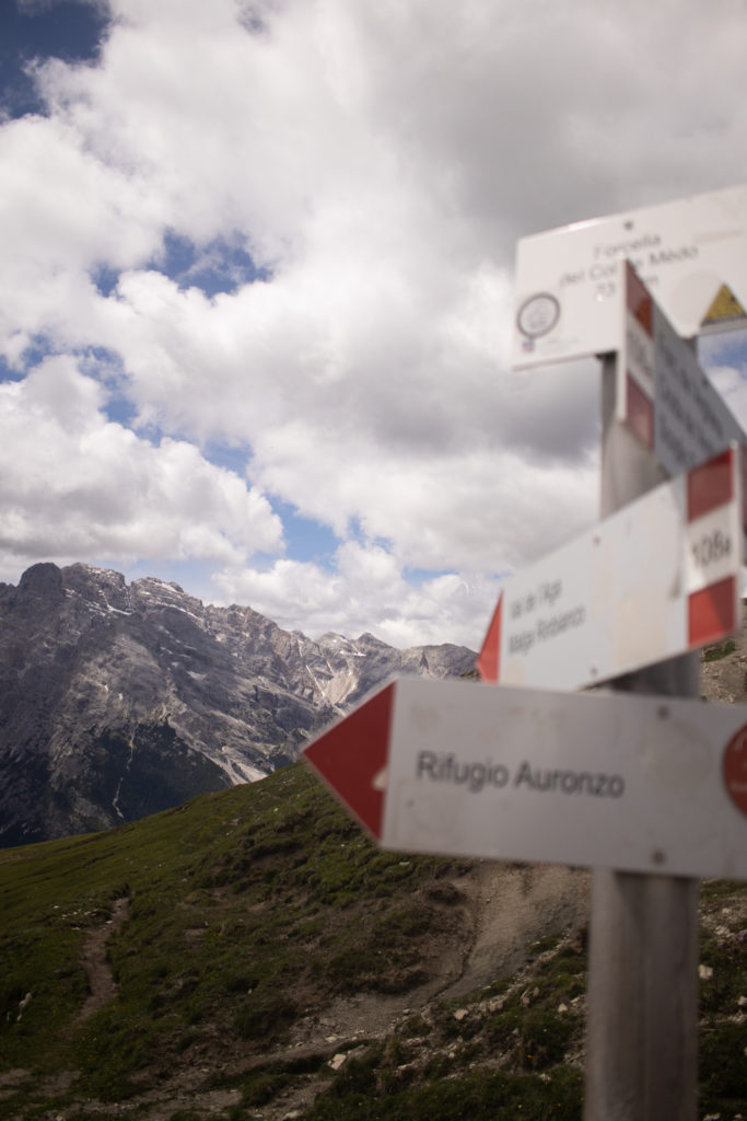
The Tre Cime Di Lavaredo Trailhead:
The Tre Cime Di Lavaredo loop hike begins and ends at the Rifugio Auronzo. Rifugio Auronzo has several large parking lots as well as a washroom availability. The washrooms do cost 1 euro each and are squatty potties so come prepared. The trailhead is located just behind the main building and is well labelled, it’s hard to miss.
When Does Hiking in the Dolomites Start?
Access to hiking in the Dolomites begins the beginning of June and continues until mid September. As the Dolomites are in the Northern area of Italy there may still be snow on the ground in the beginning of June and some (or all) of the Refugios will be closed. While you can still hike at this time, make sure you are wearing the appropriate footwear and pack a lunch. Furthermore, July and August will be busy times to hike so ensure you get to the trailhead early to get your parking spot.
The Tre Cime di Lavaredo Loop Hike
We’ve broken the hike down into 4 sections. An overview is below, keep reading to review the details of each section.
- Rifugio Aurenzo (trailhead parking lot) to Forcella Lavaredo Viewpoint | 40mins, 2.2km
- Forcella Lavaredo to Rifugio Locatelli | 40mins, 2.2kms
- Rifugio Locatelli to Malga Langalm | 1.5 hour, 3.6kms
- Malga Langalm to Rifugio Aurenzo (trailhead parking lot) | 45mins, 2.6kms
Rifugio Aurenzo (trailhead parking lot) to Forcella Lavaredo Viewpoint | 40mins, 2.2km
The hike starts off with a wide, gravel path (path 101) that leads you along the base of Tre Cime Di Lavaredo. You’ll pass a small alpine church on your right and then pass Rifugio Lavaredo, which is a smaller Rifugio with a large deck for resting. After you pass these building, the trail will curve to the left and you’ll approach the Forcella Lavaredo Viewpoint, this is a great spot to get those photos of the Tre Cime Di Lavaredo.
Forcella Lavaredo to Rifugio Locatelli | 40mins, 2.2kms
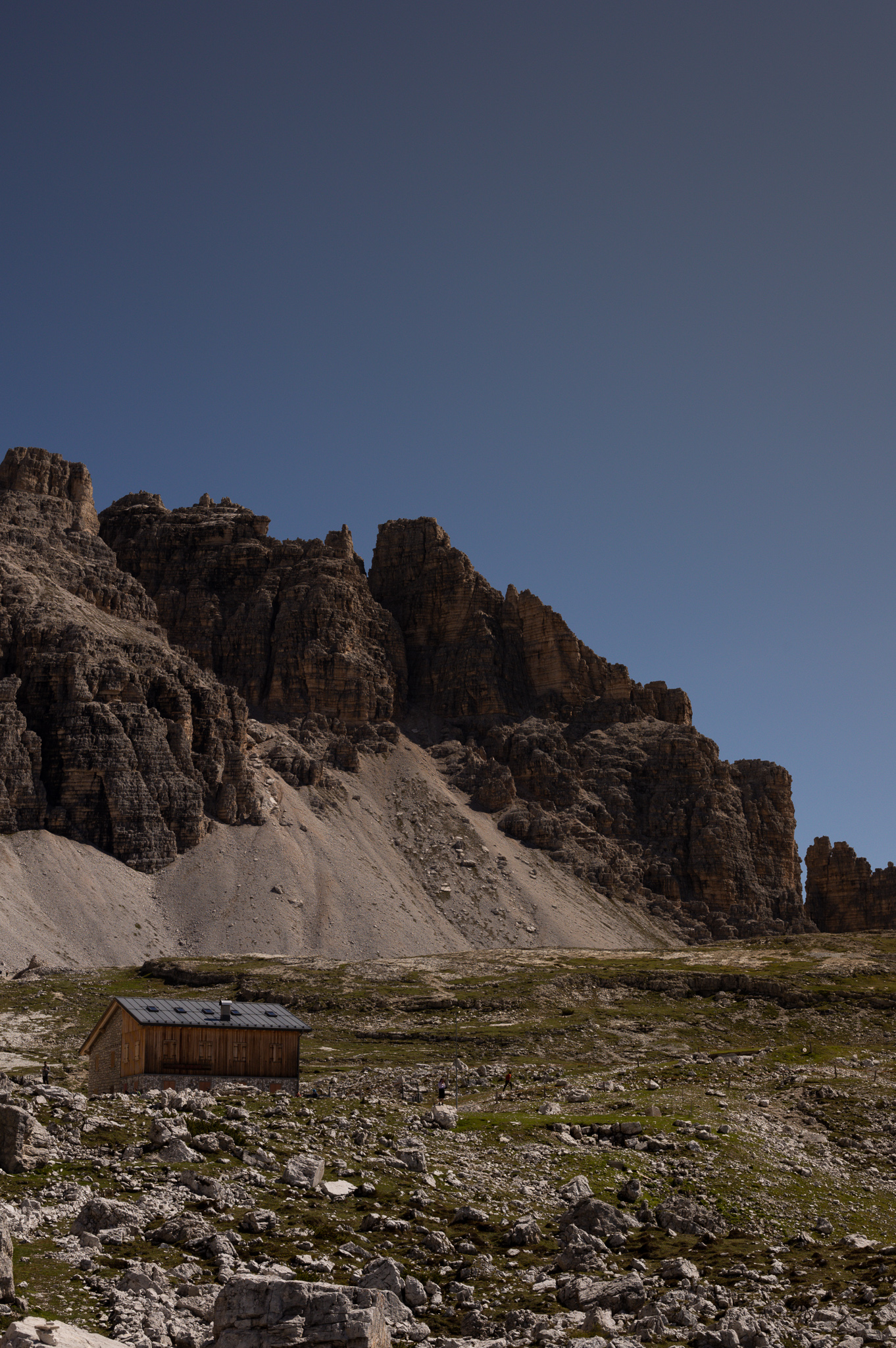
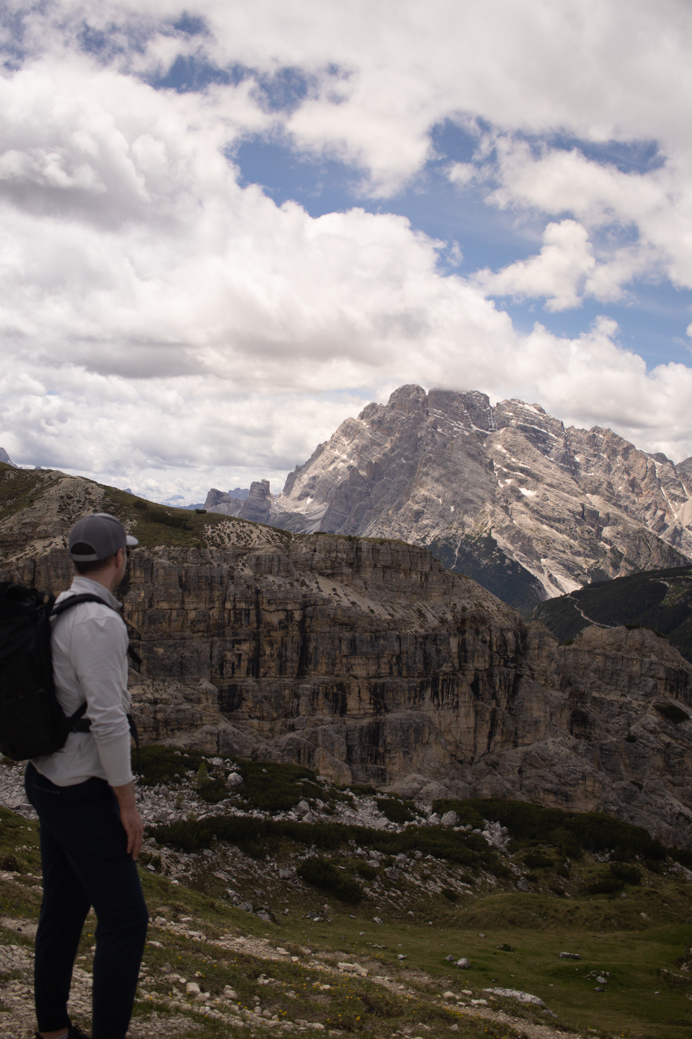
From here, you’ll start walking towards Refugio Locatelli (also called: Drei zinnen hütte). The path is once again a heavily trafficked and gravel path. As you approach Rifugio Locatelli don’t forget to look backwards at the incredible views. The Rifugio Locatelli is a white walled, orange-roofed, building that’s a hotel as well as a good spot to stop and eat lunch. During peak season, this rifugio will also serve beer and some food.
WWII Bunkers: From Rifugio Locatelli you can actually see WWII bunkers carved into the mountain side, it’s about a 10-20 minute hike up to them. We highly recommend going and checking these out. Not only do you get to see a piece of WWII history, but the views from here are stunning.

Rifugio Locatelli to Malga Langalm | 1.5 hour, 3.6kms
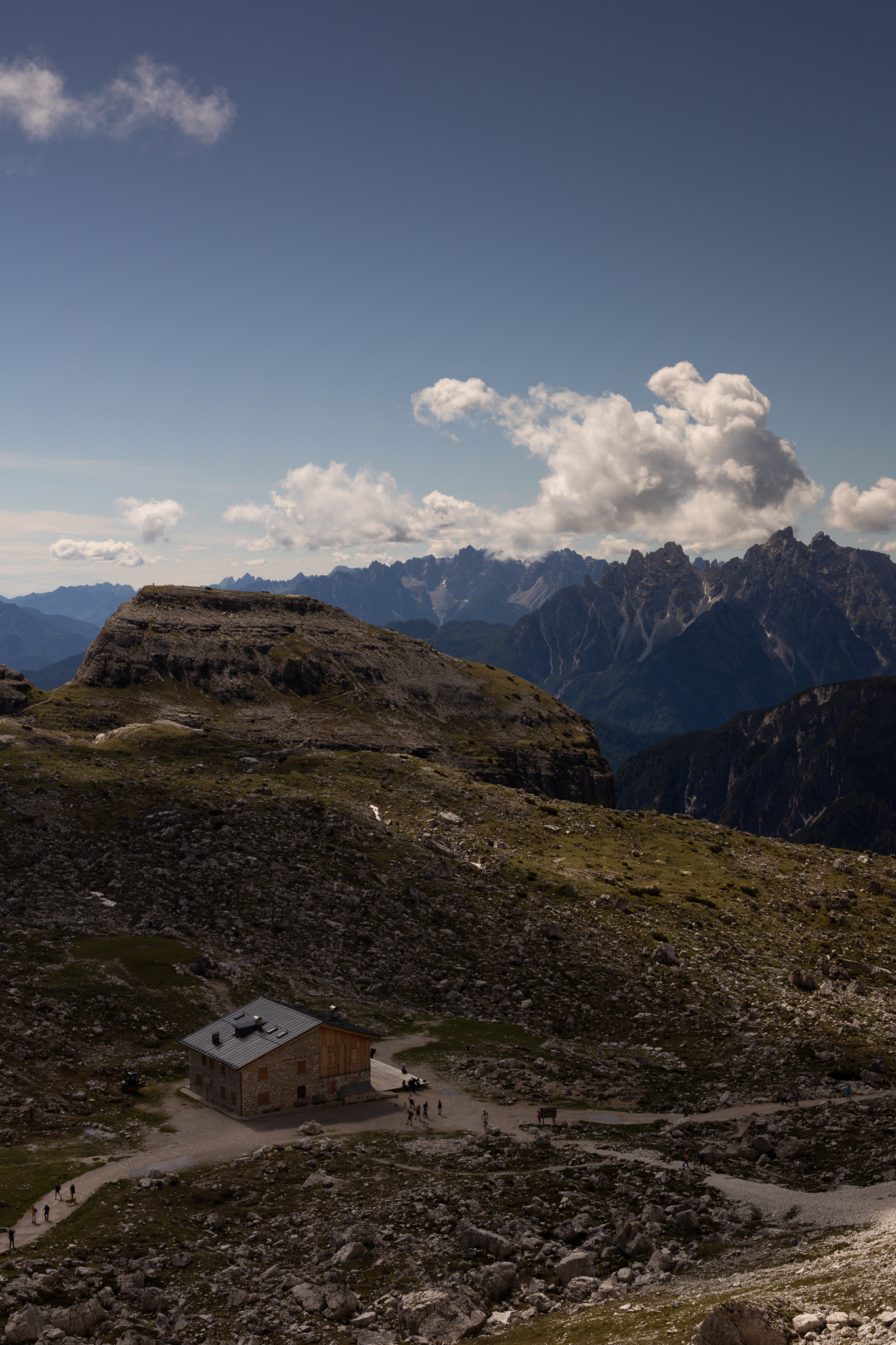
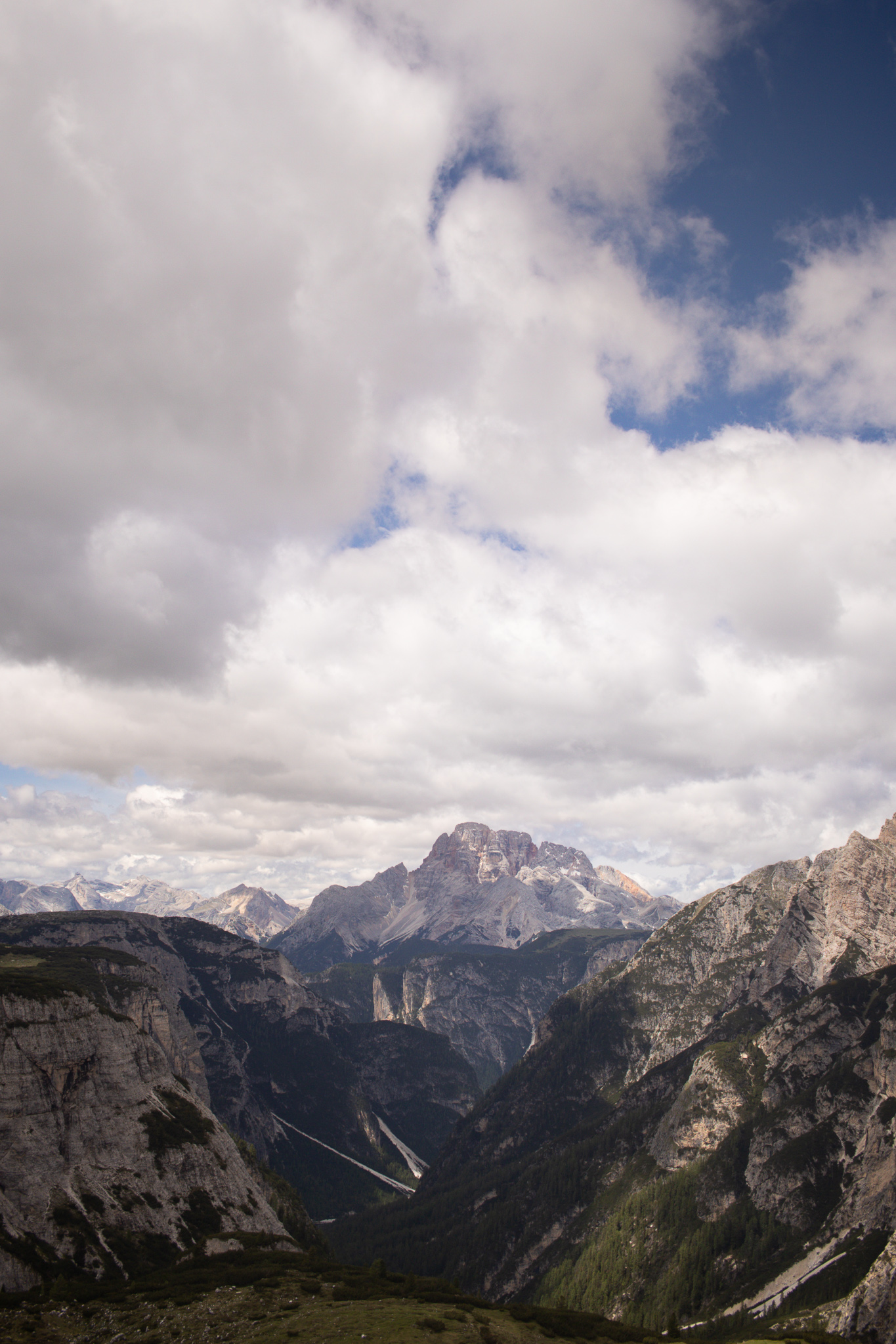
From Rifugio Locatelli, you will follow the path (path 102) and drop down into the valley. This section of the trail takes you hiking along the “backside” of Tre Cime Di Lavaredo. This is where you will meet the steepest and most challenging part of the hike. The challenge is from the long incline, the trail remains well packed down and easy to access. As you plateau after the incline, join up with the path 105. This path takes you across the stream and towards Malga Langalm. If you haven’t eaten lunch yet, stop here to have a break. During peak season, Malga Langalm does offer food and drinks and is probably the best (and busiest) rifugio along the trail.
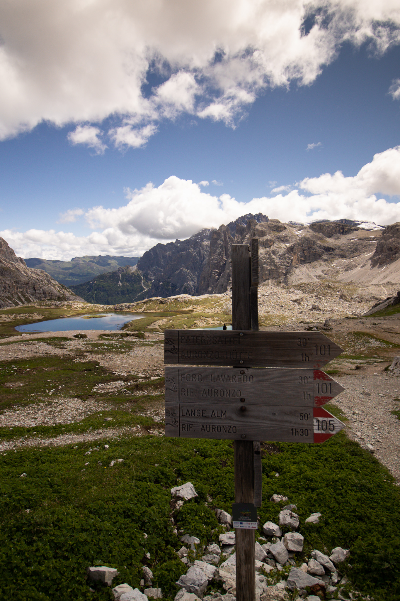
Malga Langalm to Rifugio Aurenzo (trailhead parking lot) | 45mins, 2.6kms
After Malga Langalm, you will start on the last leg of this hike as you head pack to Rifugio Aurenzo and the parking lot. For this section of the hike you will continue on path 105. The hike is relatively easy and flat from here on out, however it continues to offer stunning views of Puster Valley.
Overall, the Tre Cime Di Lavaredo loop hike is the perfect hike to do in the Dolomites. It captures the beauty of the jagged limestone mountain ranges and has an easy to follow trail making it easier to access.
Tips for Hiking in the Dolomites:
- Pack water. Pack more water than you think you will need for this hike. Also bring snacks and food that offers protein and carbs to keep you going on this long trek.
- Leave no trace. Bring out what you bring in. Nature is best enjoyed without litter, so make sure you leave it as is or better than you found it. This includes staying on the trail and not bringing nature home with you.
- Know your Directions. Knowing where to go on the trail can be key, especially for trails that have no cell service. We love and rely on the AllTrails website and app. The app even has an upgraded version that allows you to download hiking trail maps to your phone.